
Journal·May 1, 2026·geology · sedona-history · red-rocks · nature · local-knowledge
Four Hundred Million Years in the Making: How Sedona's Red Rocks Actually Formed
The red rocks outside your window aren't just scenery — they're a readable record of ancient seas, desert dunes, and slow geological violence
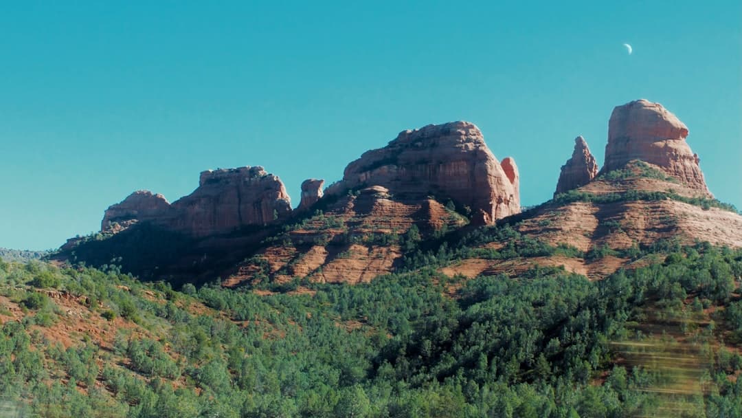
Photo by Jonathan Marchant on Unsplash
Sedona sits inside one of the most legible landscapes on Earth. Every cliff face is a page. If you know what you're looking at, you can read roughly 400 million years of history without moving more than a few miles. I've been guiding people around these formations for years, and the geology question comes up constantly — usually on a hike, usually when someone stops and just stares. Here's what I tell them.
It Started at the Bottom of a Sea
The oldest rocks visible around Sedona — the dark, purplish-gray basement you sometimes see at the base of canyon walls — are Vishnu Schist, around 1.7 billion years old. You don't see much of it here, but it's the foundation everything else stacked on top of.
The more relevant story starts around 300-350 million years ago, when this entire region sat near the equator under a shallow tropical sea. That sea deposited thick layers of limestone and mudstone, which eventually became what geologists call the Supai Group — the deep, burgundy-red layers you see at the base of most formations. The red color comes from iron oxide. Rust, essentially. Ancient ocean sediment, oxidized and compressed over millions of years.
After the sea retreated, a vast river delta took its place. More sediment. More layers. More time.
Then Came the Desert
Around 270 million years ago, the climate shifted dramatically. What is now Sedona became part of an enormous inland desert — think Sahara-scale sand dunes, stretching across much of what's now the American Southwest. Those dunes hardened into the Coconino Sandstone, a pale, cream-colored layer you can spot above the red in places like the canyon walls near West Fork or along the drive up toward Oak Creek Canyon.
The cross-bedding in Coconino Sandstone — those diagonal lines you see in the rock face — are actually fossilized dune slopes. Wind-blown sand, frozen in stone. I find that particular fact hard to get past. You're looking at a dune from 270 million years ago.
After that desert period, another shallow sea moved in. It left the Kaibab Limestone capping the tops of some formations — often the pale, almost white layer at the very top of taller mesas.
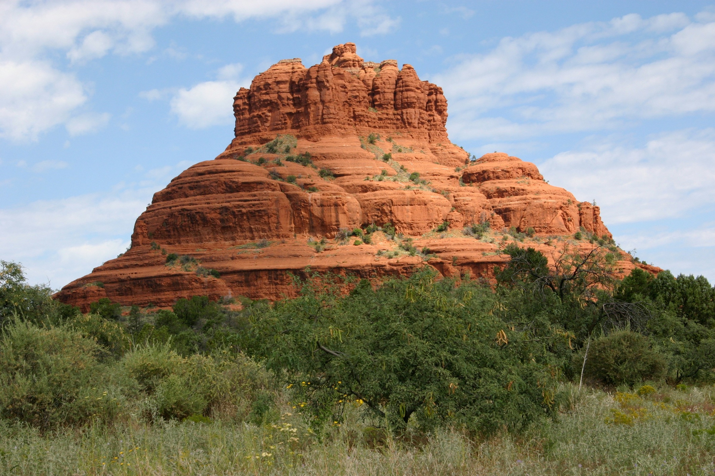
Bell Rock near the Village of Oak Creek — the horizontal banding shows distinct geological layers laid down across different eras. The dark base, the red mid-section, the lighter cap tell the whole story if you look.
The Uplift That Made It Visible
All those layers sat relatively flat and buried for a long time. The reason we can see them today is the Colorado Plateau uplift — a geological event that began roughly 65 million years ago and continued over tens of millions of years, gradually pushing this entire region upward. The plateau rose without much folding or tilting, which is why Sedona's layers are still so horizontal and readable.
Once the rock was elevated, erosion took over. Water, wind, and freeze-thaw cycles carved the plateau down. Oak Creek, running north to south through the canyon, did a significant share of the cutting. The formations you see — Cathedral Rock, Bell Rock, Courthouse Butte, the Coffeepot — are what's left after everything around them eroded away. The rock that remains is harder or more protected. The rest is gone.
The formations aren't permanent, by the way. They're still eroding. Slowly, but measurably.
Why They're That Color
The red. Everyone asks about the red.
It's iron. The Supai Group and the overlying Schnebly Hill Formation — the dominant red layer that gives Sedona most of its color — contain iron-rich sediments that oxidized as they were exposed to air over millions of years. Hematite, specifically. The same compound that makes rust red makes these rocks red.
The intensity of the color changes with light, which is why the rocks look almost orange at sunrise and closer to a deep wine red in late afternoon shade. You're not imagining it. The angle of light hitting iron oxide minerals actually does shift the apparent color. Late afternoon, if you're up near the Airport Mesa overlook or anywhere with a west-facing view, the color gets almost unreasonably saturated.
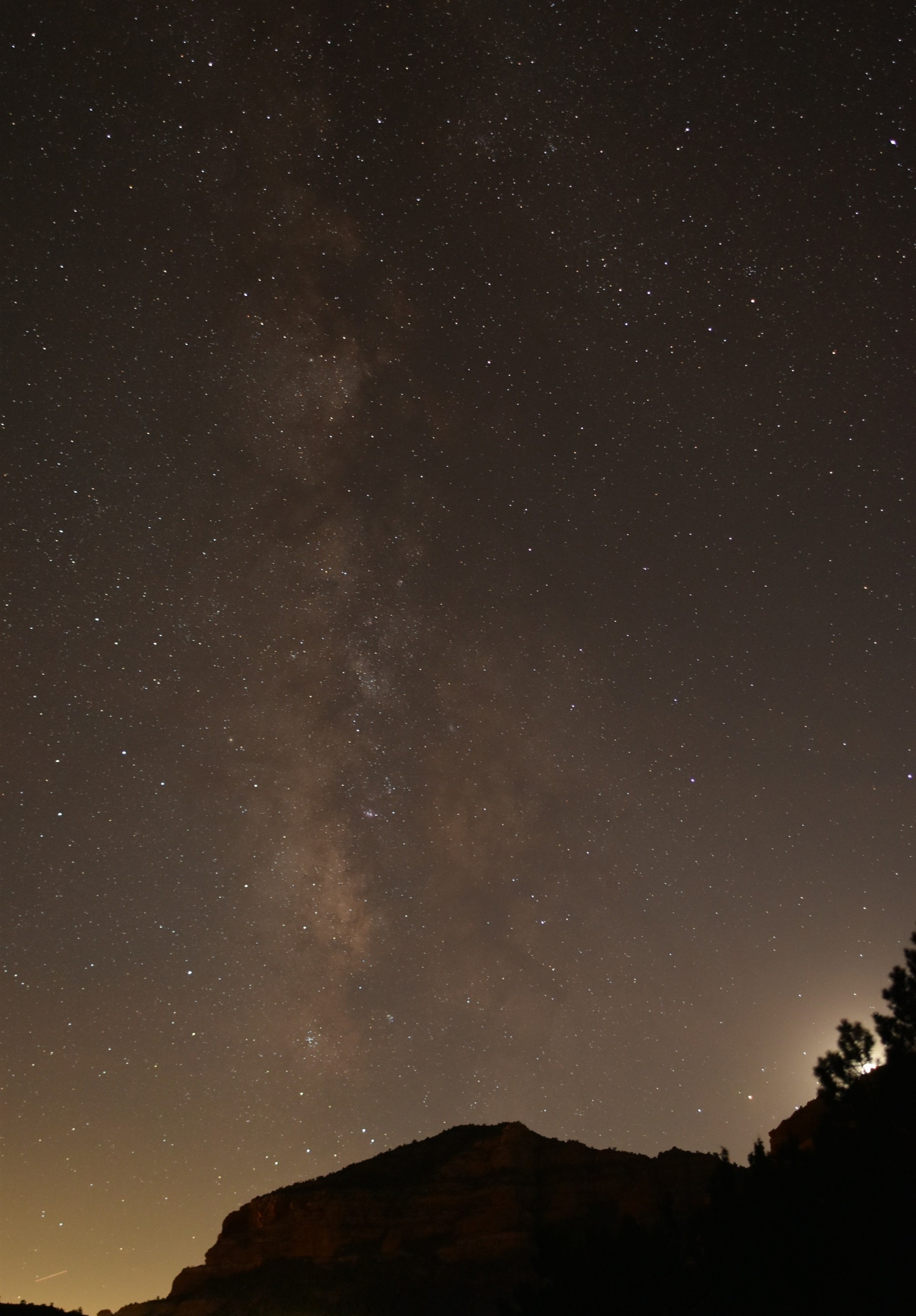
The same formations after dark. The iron that makes them red during the day makes them into stark silhouettes at night — one of the cleaner views of the Milky Way you'll find at this elevation.
What to Look For On Your Next Walk
You don't need a geology degree to read the rocks. Next time you're on a trail, look for the horizontal banding. The dark purplish base. The deep red middle layers. The pale sandstone above. The white cap, if the formation is tall enough to have one.
The Courthouse Butte Loop near Bell Rock is one of the better spots to see the full sequence in one view — the formation is wide enough and the trail keeps enough distance that you get the whole cross-section at once. Takes about an hour and a half at an easy pace.
If you make it out here, take ten minutes on that trail to just look at the rock face without moving. The layers aren't subtle once you know they're there.
Notes from Sedona
Want these in your inbox?
Once a month I send the new posts straight to subscribers. Skip checking the site.